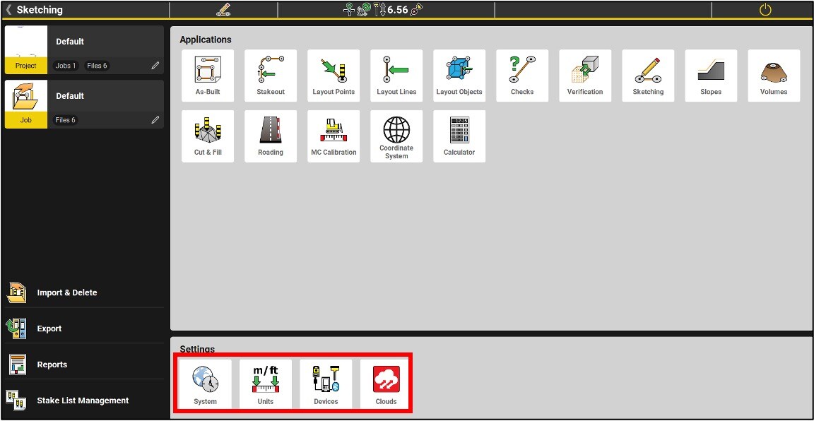
Settings
4 menus are offered
System (options, licenses, version, language, display, sounds, etc.)
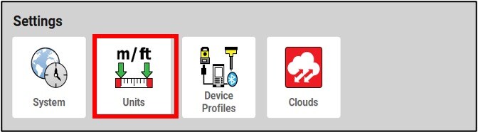
Units (units displayed in the software and quality control)
Devices (profiles of GNSS sensors or total stations connected to the CC80)
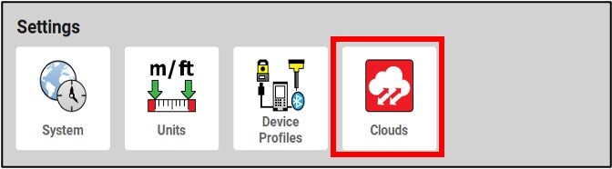
Clouds is an optional service that is displayed there if it is available.
System

About; At the top of the software box, you will see the version of the installed iCON software.

Online Map: Allows you to download a map from Microsoft Bing Online Maps and use it as background image. Two types of maps are available: aerial view and road map.

User Permissions: Selection of programs that are displayed in the main menu.
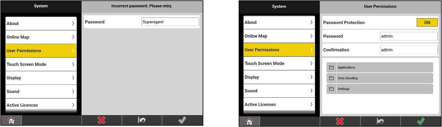
* The password is superagent
Touch Screen Mode: choice of 3 sensitivity modes:
- Touch / Pen
- Touch / Water
- Touch / Pen / Glove

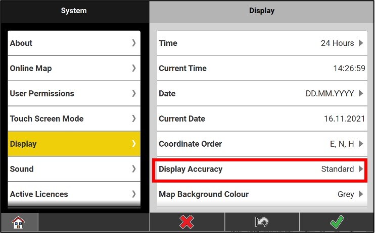
Display: screen settings.
The setting Display Accuracy determines which of the 3 choices is selected between : Simple, Standard, and Precise.
To work, the Standard is adequate (3 decimal places and 5 arc seconds), while for checking the instrument, the Precise (4 decimal places and 1 arc second).
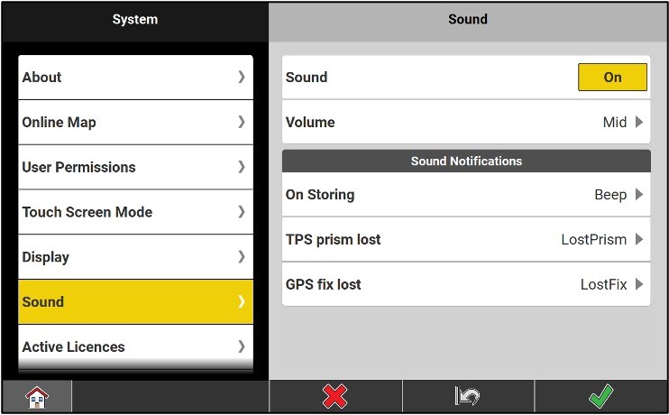
Sound: notification sound settings.
Active Licenses: information on active applications, software license key (15 characters series) and maintenance end date.
A button allows you to update the licenses already loaded in the tablet. For example, a CCP or an application.

The Software Maintenance End Date, or SPC End Date, is the date until which all versions of the iCON software belong to you.
If you want to upgrade your software and your maintenance end date does not allow it, then you must purchase a new CCP.
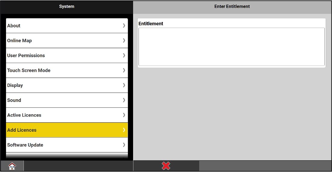
Add licences: new licence activations.
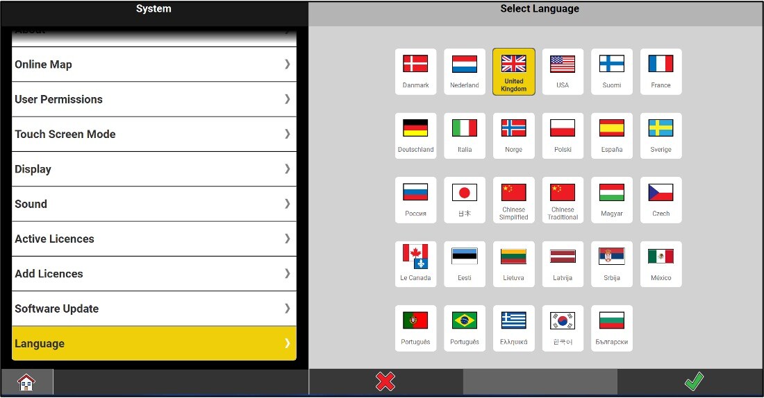
Language: selection of the display language.
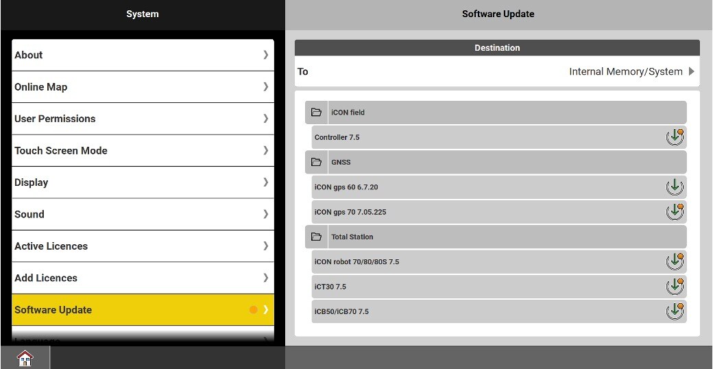
In "Software Update" the latest updates can now be downloaded directly to the tablet, without going through myWorld.
Available for the following equipment:
- CC70/80/170/180/200
- iCG60
- iCG160
- iCG70
- iCR70/80/80S
- iCT30
- iCB50/70
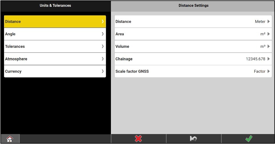
Units Menu
In the sections Distance, Angle and Atmosphere, you will have different choices of working units for distances, derived quantities, angles, slopes, pressure and temperature.
Tolerances (quality control): determination of the quality thresholds that will be accepted by the instrument. 3 predefined configurations are offered:
- Tolerant
- Medium
- Precise
You can also define up to 10 additional custom configurations.

Shown in the image above we see the configuration of the CQ according to bob’s tolerances
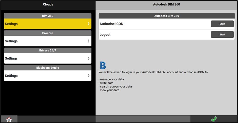
Clouds
The Clouds menu provides access to remote control, as well as data transfer between the field and the office. A subscription and an internet connection are required to use these services.
BIM 360: Import and export any type of data to the Autodesk BIM360 cloud.
Procore: Enables connectivity to Procore Construction Project Management storage software improving ease of BIM workflow.
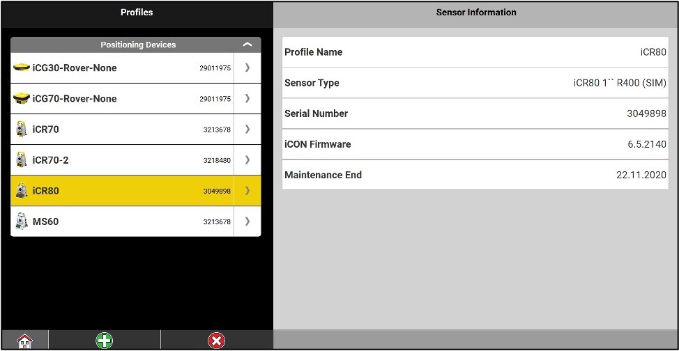
The Devices settings
Each existing sensor profile allows a quick connection to a specific instrument with its specific settings : It can be a GNSS sensor, a robotic total station or a MultiStation MS60.
Icon data collectors can also connect to stations outside iCON product line that run Captivate software, such as the TS16, TS60 and MS60.
The steps for creating a sensor profile vary depending on the type of instrument and its use: mobile GNSS antenna (different types of RTK correction transmission), GNSS RTK correction transmitting antenna (base), total stations.
By clicking on the arrow on the right of the sensor, you have a few options…
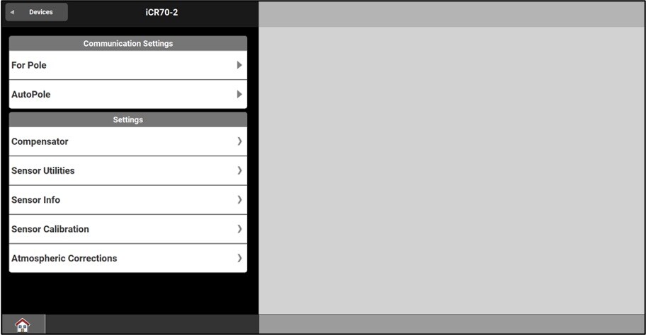
Screenless Total Station:
You can access the level, the software update, the instrument information, the field calibration, and the adjustment of the atmospheric corrections from the devices menu.
Total station with screen:
You only have access to the level, the information on the instrument and the adjustment of the atmospheric corrections. The collimation in progress and the updates will be done from the interface on the station.

For a GNSS antenna, you can change the sensor profile and the communication link.

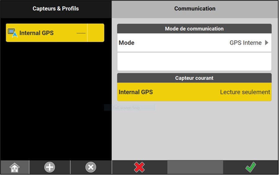
Since version 4.5, it is possible to use the internal GPS of your data collector
Simply create a sensor profile and choose ‘Internal GPS’ as an instrument type (driver installation is required).
The accuracy, however, will no longer be of the order of centimeters, but rather of the order of a few meters, as a handheld GPS can offer. This sensor is ideal for locating oneself on a construction site when you do not have a precision GNSS system.
Communication modes
When using a robotic total station, ensure that the device is in the correct communication mode via the radio handle :
COM or BT light must be red and if it is not, for the iCR50, hold down the ON/OFF until it turns red. For the iCR70 or iCR80S, press the COM, until the light COM becomes red.
The ON/OFF light on the radio handle must be green.

* If you have difficulties connecting you canon hold the com button for 10 sec to reset the bluetooth