
Coordinates section
- Anywhere (resection) : The station is installed any where and targets known points.
- Over known point: The station is installed on a known point; the height of the instrument is measured, and another known point is targeted.
- Set Orientation: The station is installed on a known point; we measure the height of the instrument, and we aim at an element whose bearing is known (the azimuth).
- Setup Pilot: Automated resection. It is necessary to configure the control points. A license is required for this method.

Control Line section
- Anywhere (resection) : The station is installed anywhere, and targets known points on an existing line.
- Alignement: The station is installed on the starting point of a line, and we aim at a point of this same line to define the orientation of the instrument.
- As Built Walls: The station is installed anywhere and uses four points on two walls to create two axes with which it will determine its position in 2D.

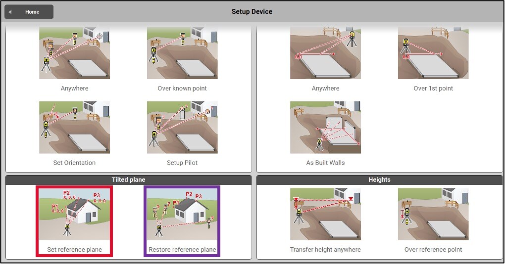
Tilted plane section
- Set reference plane: The station is installed anywhere and we aim at 3 points of an inclined plane to be able to work with altitudes perpendicular to this surface.
- Restore reference plane: The station is installed anywhere and is aimed at 3 points of an inclined plane to be able to work with altitudes perpendicular to this surface. We can also add other points outside the inclined surface to allow verifications during the work period.
Heights section
- Transfer height anywhere: determines the elevation (Z) of the station by reading a known point or entering an elevation.
- Over reference point: determines the elevation of the station by measuring the difference in height between the station and a reference point.
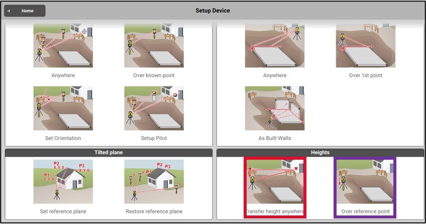
The Heights setups allows you to work with the instrument in the same way as with a level or a laser. This type of setting up is faster and only requires a height reference (known or arbitrary). They do not determine the orientation of the device
Anywhere setup
The steps of a free stationing
Level the instrument and navigate to the second page by pressing the yellow circle (or blue).

Enter the stationing information:
- Station name or number
- Instrument height (optional, not required if you do not wish to create a physical station at this location)

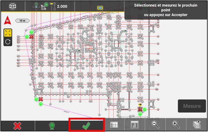
Select the first control point and record the measurement. Repeat this process for the second control point. For better accuracy, it’s recommended to use at least three control points. After recording the measurements, check the differences with the certificate available at the bottom of the page.
If necessary, select the points that are used (XY and/or Z). Ensure that these points meet the previously defined tolerance. Once you’re satisfied, accept the points with the green checkmark.

Accept the station setup with the green checkmark.
Stakeout another point to verrify your setup or go back to the setup menu to add an elevation